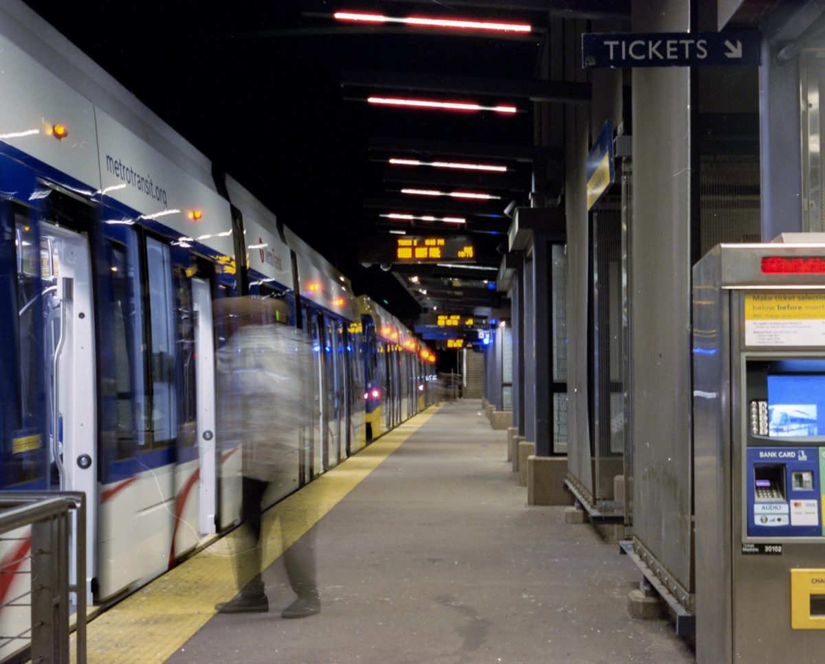


Citywide transit maps are nothing new, but researchers at the U.S. Department of Transportation are working to map transportation coasttocoast, complete with bus routes, stops and schedules.
Information provided by state transportation departments are often presented in different ways or gathered under varying conditions, said DOT Chief Data Officer Dan Morgan. Without consistent data sets, researchers have struggled to compare transit and its effects on a countrywide scale.
“When you look at the data we do have, we know where the airports and … our roads are,” Morgan said, “but we don’t have an open dataset of where transit is and how well it serves the community.”
With funding from the Bureau of Transportation Statistics, the department asked its state-level counterparts for permission to access their records so they could piece together information and publish it as openly searchable data, Morgan said. Though more than 100 U.S. transit agencies do have the data the DOT needs, many do not, he said.
“For us to be able to understand how well communities are connected to opportunities, education, health care, jobs and recreational opportunities, we need to better understand … transit-scheduled service,” he said. “Then we can drive a meaningful conversation on how we can work together as a nation to close any gaps.”
The DOT expects to release a first version of the map this summer, he said, adding that he hopes the initial release will convince more agencies to participate in future iterations. Depending on how many agencies get involved, he said, the map will likely be updated on an annual basis.
“The answer can’t be, ‘Let’s just build more transit,’” Morgan said. “It’s also about … making sure communities have the data about where transit is, where affordable housing is and where opportunities are to start to drive a different urban planning conversation.”
Accessibility evaluation study
The nationwide transit map is similar to one developed at the University of Minnesota’s Accessibility Observatory that measures people’s ability to reach jobs.
The National Accessibility Evaluation Pooled-Fund Study examines 11 million census blocks around the U.S. to determine how accessible people are to destinations and jobs.
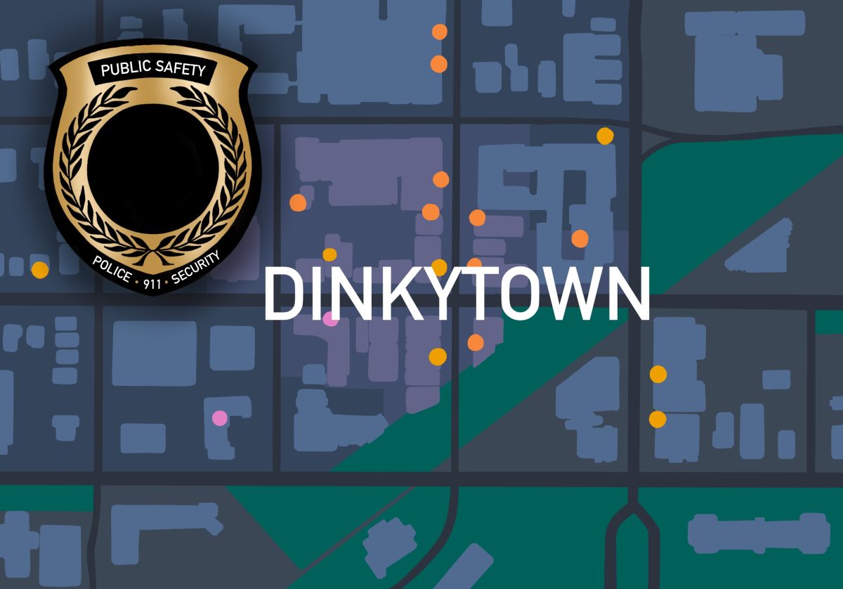
“If you live in Dinkytown, the question is how many jobs can you reach in 10 minutes, 20 minutes, so on and so forth,” said
Accessibility Observatory managing director and University civil engineering professor David Levinson. “Using network attributes, we would compute which of the other blocks you could reach within a given time, a given time of day, through a given mode of transportation.”
He said transit accessibility can help explain the value of property — which houses are more expensive, where and why — and how different cities can boost productivity.
“There’s a lot of evidence that shows places that are highly accessible have higher economic output per person,” Levinson said. “People are more efficient when they reach a place or a person in a shorter amount of time.”
The University study also aims to help inform public transportation policies, he said. Researchers have been working across nine state transportation departments to produce highway and transit maps.
“We’ve been using the kind of data [the DOT] is putting into the National Transit Map for a few years,” Levinson said. “It’s good of them to put it all in one place because we’ve had to get a lot of data from different agencies, so if there is a systematic way of organizing the data, that’s a good thing.”
Citywide transit maps are nothing new, but researchers at the U.S. Department of Transportation are working to map transportation coasttocoast, complete with bus routes, stops and schedules.
Information provided by state transportation departments are often presented in different ways or gathered under varying conditions, said DOT Chief Data Officer Dan Morgan. Without consistent data sets, researchers have struggled to compare transit and its effects on a countrywide scale.
“When you look at the data we do have, we know where the airports and … our roads are,” Morgan said, “but we don’t have an open dataset of where transit is and how well it serves the community.”
With funding from the Bureau of Transportation Statistics, the department asked its state-level counterparts for permission to access their records so they could piece together information and publish it as openly searchable data, Morgan said. Though more than 100 U.S. transit agencies do have the data the DOT needs, many do not, he said.
“For us to be able to understand how well communities are connected to opportunities, education, health care, jobs and recreational opportunities, we need to better understand … transit-scheduled service,” he said. “Then we can drive a meaningful conversation on how we can work together as a nation to close any gaps.”
The DOT expects to release a first version of the map this summer, he said, adding that he hopes the initial release will convince more agencies to participate in future iterations. Depending on how many agencies get involved, he said, the map will likely be updated on an annual basis.
“The answer can’t be, ‘Let’s just build more transit,’” Morgan said. “It’s also about … making sure communities have the data about where transit is, where affordable housing is and where opportunities are to start to drive a different urban planning conversation.”
Accessibility evaluation study
The nationwide transit map is similar to one developed at the University of Minnesota’s Accessibility Observatory that measures people’s ability to reach jobs.
The National Accessibility Evaluation Pooled-Fund Study examines 11 million census blocks around the U.S. to determine how accessible people are to destinations and jobs.
“If you live in Dinkytown, the question is how many jobs can you reach in 10 minutes, 20 minutes, so on and so forth,” said
Accessibility Observatory managing director and University civil engineering professor David Levinson. “Using network attributes, we would compute which of the other blocks you could reach within a given time, a given time of day, through a given mode of transportation.”
He said transit accessibility can help explain the value of property — which houses are more expensive, where and why — and how different cities can boost productivity.
“There’s a lot of evidence that shows places that are highly accessible have higher economic output per person,” Levinson said. “People are more efficient when they reach a place or a person in a shorter amount of time.”
The University study also aims to help inform public transportation policies, he said. Researchers have been working across nine state transportation departments to produce highway and transit maps.
“We’ve been using the kind of data [the DOT] is putting into the National Transit Map for a few years,” Levinson said. “It’s good of them to put it all in one place because we’ve had to get a lot of data from different agencies, so if there is a systematic way of organizing the data, that’s a good thing.”